Leg 2: Hotham Sound to Port Hardy
|
Date |
|
Route
(see Chart) |
Weather |
|
July 5/06 |
|
Hotham Sound to |
Warm, cloudy morning, clearing in afternoon |
Click on Pictures to Enlarge
|
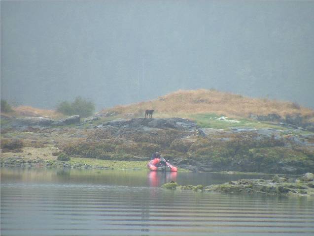
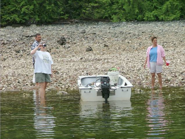
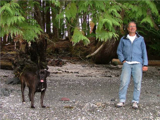
Gathering Oysters and Clams before Departure with the crew from the
Kona observing the gathering
process while surrounded by oysters
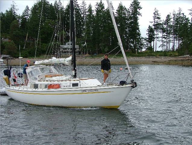
Taking on Wave while exiting
Jervis Inlet on our way north to
A fellow cruiser headed for
Toast to Launch the 3rd
Anniversary Cruise “Alone at Last” |
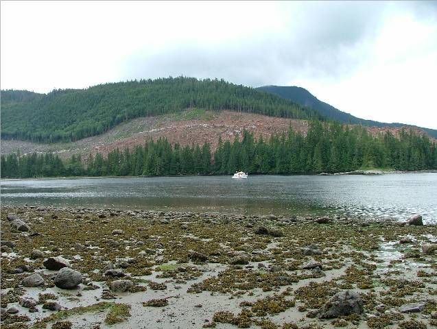
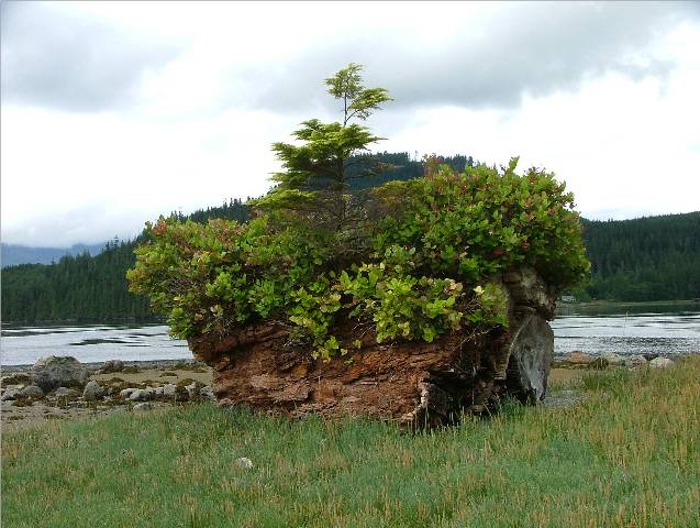
Captain Gordy and I had another date for early oyster gathering. Again our mates remained behind but later joined us to lend a hand. The oysters were plentiful on this beach but on the small side. Knowing there are no other openings for shell fish this might be our last pick-up for several weeks if that.
Soon after we weighed anchor and bid farewell to the The wind was blowing off our port bow when we exited
Jervis Inlet and the sea was gnarly.
Once we got out further we were able to point our bow northward and
take the waves off our stern. The sea
became calmer as we reached the protection of We stopped and anchored off the Along the way we admired some of the homes along the
shoreline and the dock at Bliss Landing. We settled down for the evening and had our traditional celebratory toast to our Third Anniversary Cruise with a “wee dram” of fine Irish Whiskey. We dined on delicate clams in spicy Alfredo sauce and enjoyed a quiet and relaxing evening with just the two of us. The wind picked up after supper and the southerlies were making their way into the bay. It was a bit rocky through the night but the exhausting weekend had caught up with me and I slept through it, which isn’t typical. |


|
Date |
|
Route (see Chart) |
Weather |
|
July 6/06 |
|
|
Cool, cloudy and misty, bit of clearing in the evening |
Click on
Pictures to Enlarge
|
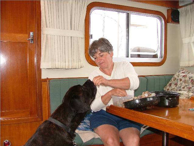
SV Saltire Departs Don and Allison onboard
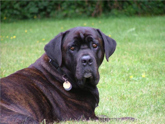
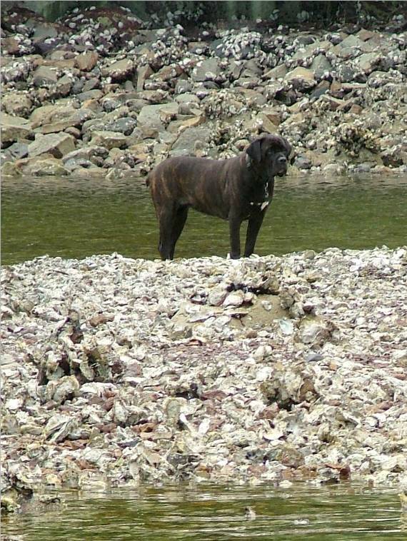
Kona enjoying a few tidbits from the Hotham Sound Clam
Harvest
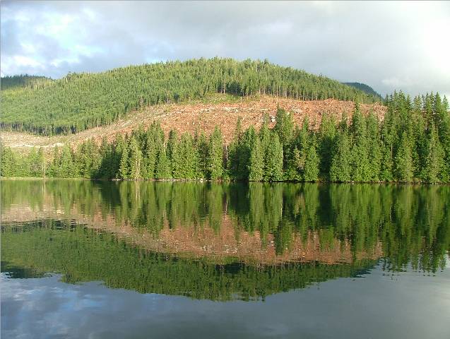
Boats in the mist of Dent Rapids
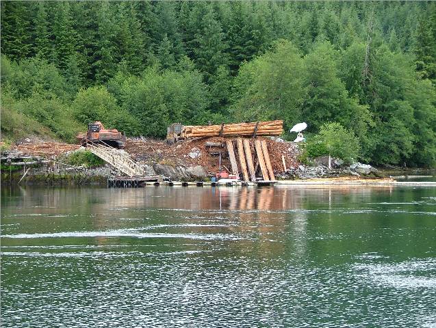
Log Dump at
Charles Bay Logging Area adjacent
Erasmus Island Log Dump Looks Like a T-Rex Dinosaur with
his mouth open to me!
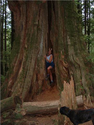
Carol-Ann eaten by Big Cedar (Honeymoon Cruise 2003)
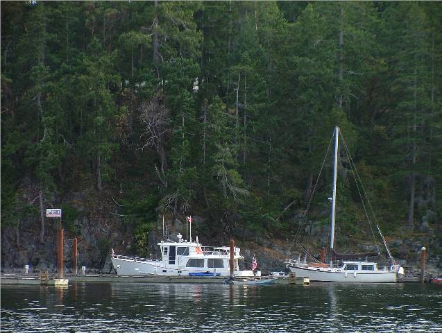
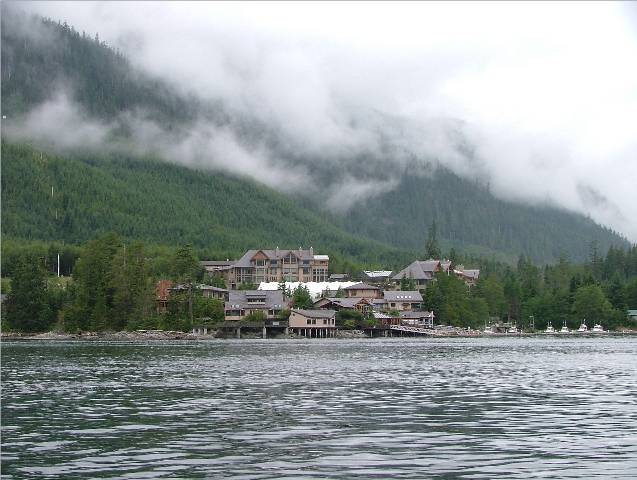
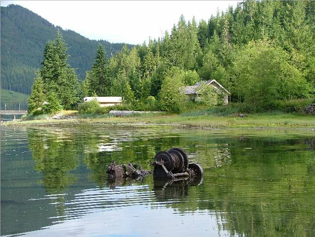
Donkey near Blind Channel Resort |
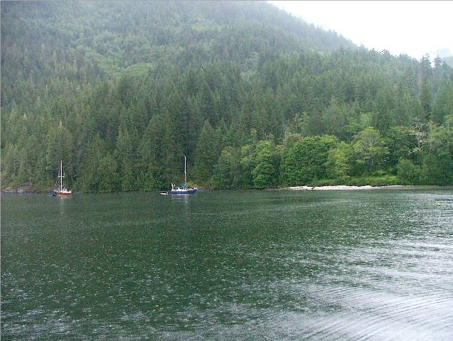
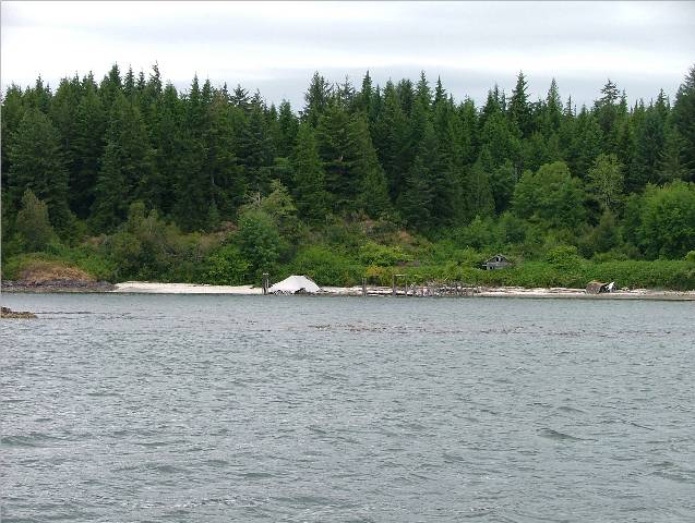
The wind was still blowing strong when we woke up. The SV Saltire pulled up beside us to say
goodbye as they headed off to We spent the day doing boat chores: clam shucking, log writing, picture editing and general boat tidying. We had the current in our favour and enjoyed a leisurely cruise up to Cordero Channel averaging 8.5 knots. We hit Yuculta Rapids while it was just beginning to ebb so the ride through Big Bay and Dent Islands at the north end of Sonora Island was easy with very little current interfering with us. It rained a wee bit but we could use a fresh water wash on our now salty windows. We had thought we would anchor in Shoal Bay for the night
and did stop at the mouth of the bay to have a look but decided to carry on
to Blind Channel while we still felt like traveling and had all things in our
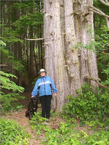
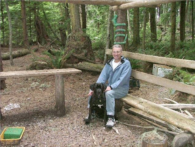
favour. As we motored past We pulled into Once anchored we took the Catch-Up and Kona over to We tied up the Catch-Up and carried on for a walk through the CanFor forest trails. We had hiked here three years ago during our Honeymoon Cruise after hearing that it was an old growth forest. Some of the cedars along the trail are mammoth. We chose Viewpoint Trail, the shortest one, rather than spend a lot of time hiking. We wanted an early supper and a good night’s sleep which, so far, had not been the typical schedule since this trip started. When we started the hike there was a sign cautioning us to be aware of animals in the area: cougars, bears and wolves. I had forgotten to attach my bear bell to my bootlaces so instead I chattered away to Kona and sang to scare the bears away as we walked. We stopped on the way out to speak to a boater aboard his
sixty-five foot motor yacht. He told us
he had cruised all over the world and the BC coast to The summer boating season was in full swing but there were only six boats at dock in Blind Channel Marina. We overheard two men talking about the low numbers and they determined it was because of the high cost of fuel. |
|
Date |
|
Route (see Chart) |
Weather |
|
July 7/06 |
|
Charles Bay to Matilpi Indian Islands |
Cloudy with rainy periods |
Click on
Pictures to Enlarge
|
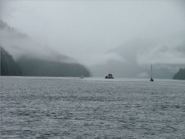
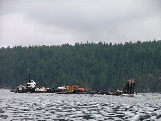
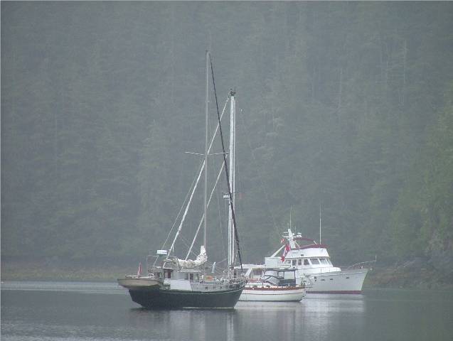
Sea Foam at Anchor in
Commercial Traffic in Sunderland Channel
Indian Island Anchorage at
Matilpi
Fellow boaters waiting out the
storm at Matilpi anchorage
Nurse Log |
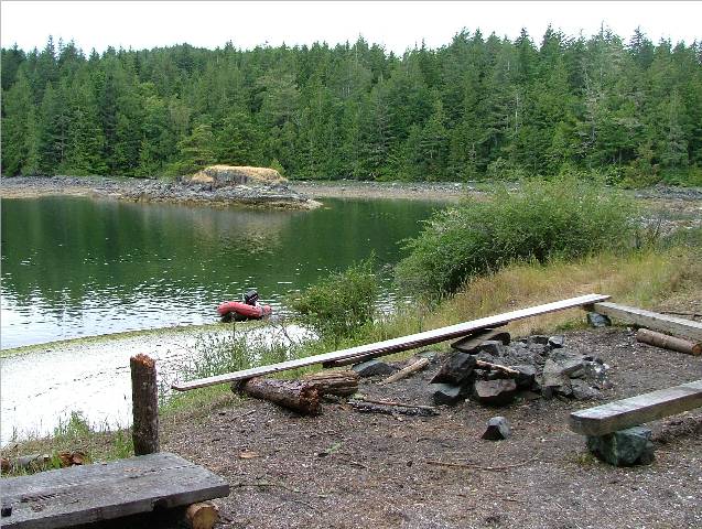
We had to time our departure carefully this morning because we had to pass through two sets of rapids to get to Johnstone Strait via the “backroads”. The weather forecast described the weather as having “unseasonable conditions” which meant to us high winds (40 knots blowing from the south predicted in Queen Charlotte Sound) bringing cold and rainy weather – winter conditions in July! This storm was predicted to appear in the late afternoon so we knew we had better get on our horse and ride. When you have traveled back and forth across the Strait of Georgia for many years, or any strait that is in your “cruising backyard”, you gain the local knowledge of the area and know what conditions spell trouble and when to attempt travel. You learn what wind and current combinations to avoid and what areas you can hide behind and negotiate depending on the weather conditions. Johnstone Strait is no different. When we first started coming up this way it was an area I dreaded. It is so long and narrow and there are long stretches where there are no good anchorages to pull into if things get rough. This is the fourth time we have traveled on it and we continue to give it a healthy respect. This is the first year we haven’t been able to cruise right through non-stop to the Plumber Islands. The last several summers we have had smooth sailing and calm seas from the start at Chatham Point to the finish at Hanson Island where the water widens into Queen Charlotte Strait.
This year, because of the predicted storm coming in the afternoon, we planned two options: to travel on it for a short stretch of two hours between Port Neville and Havannah Channel and then duck in for cover or, alternatively, if the weather looked good we would stay in the Strait and push on to Hanson Island before the storm caught up to us. We weighed anchor at 1200 and pushed through Greene Point Rapids with a three knot current pushing against us. It is just a short narrow area so we didn’t have to fight the current for long. We arrived at Whirpool Rapids at near slack so the current there was not a problem either. At 1400 we entered Johnstone Straight near Port Neville and traveled along for about two hours before turning into Havannah Channel. We could see the rain and dark clouds ahead. Using our binoculars we could also see the different color on the water ahead so we knew it was time to turn off the Strait before the waves and stormy conditions were upon us. Luckily, during our two hour stretch in the dreaded Straight we had two to three foot waves on our stern surfing us along. Once in Havannah Channel we had an immediate change of
water – smooth and calm with little wind.
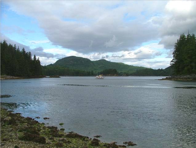
I consulted several of my cruising guides to locate an anchorage that
would protect us from the strong southerly winds predicted. Peter Vassilopoulos’
book, North of Desolation Sound gave a comprehensive map of the area and a
spot that looked like it would protect us for the night. We motored the short
distance up to Just as we finished anchoring the rain started to fall. It continued through the evening giving our boat a fresh water rinse. We would wait out the storm in this protected area. |
|
Date |
|
Weather |
|
|
July 8/06 |
|
Matilpi, Indian Islands to Mound Island |
Cloudy and windy |
|
Ruins from the
Kalugwis(Kar-luk-wees) Native Settlement.
Once a thriving fishing village in the 1940 and 50’s.
Kayak Camp near our anchorage at
Canopy Forest at
Shell Beach at
Kayak Camp at Compton Island
across from
Misty Evening at Mound Island
anchorage |
We had a peaceful night but by 0530 the winds were making themselves know on our burgee. The southerlies had found their way to our anchorage and the wind was gusting hard. Once we were up and listening to the VHS we heard one mariner speak of winds off of Cape Caution at 72 knots last night. The weather forecast called for winds to lessen and switch from southerlies to northwesterlies by afternoon and easing more over night. We decided to move on and continue through the back trail to avoid Johnstone Strait and enjoy the protected water in the small channels on the mainland side. We wanted to get closer to the edge of Queen Charlotte Strait so when the weather improves we can make a run to Sointula or Port Hardy for water and a fuel top up before we head north away from the protection of Vancouver Island and around Cape Caution. We again had to time the current through a narrow stretch of water, Chatham Channel, on our way to Beware Passage. The tide was beginning to flood and the current was against us at 0930 but only by 1.5 knots. The channel is easy to navigate although on the chart it looks very narrow. There are range markers to keep you in the centre where the water is deepest. We navigate using two GPS devices, one portable chart plotter at the helm and our lap top computer charts on the pilot house table help to clearly mark where safe water lies. Having a little green boat icon travel right on the chart showing your position makes travel in tight places much easier, eliminating virtually all of the guess work. We continued on through the Blow Hole by Minstrel Island
and then took a starboard turn into Beware Passage. On the chart you can see why it would be so
named. The first section of the pass
is riddled with rocks but we have been through before in our big boat and by
kayak and it is easily navigable. Just four short hours later we had anchored
in a long bay between Mound and Rick took Kona to shore and found a shell beach with two kayakers getting ready to leave camp and head back across to Telegraph Cove where their car was waiting for them. They said they pulled into a spot on one of the larger islands around here and once in the forest they saw a cougar lying there staring back at them. It was apparently twice as big as Kona. When they started taking pictures with a flash he got up and moved away. They were from Vancouver and the man wanted to get home by tomorrow to watch the World Cup Soccer Match! After supper we took Kona out again for further exploration of the nearby islands. We took the Catch-Up and motored through the narrow channel out into White Beach Passage and over to Farewell Harbour. We got out at Compton Island and found another kayak camp there. We no sooner arrived at our anchorage again when an aluminum boat came in through the narrow passage laden with gear and kayaks and dropped off some paying customers at the kayak site and within an hour you could see a tent up and overlooking our anchorage. The winds had finally died down and the anchorage was quiet. We retired by 2000 to start the day early tomorrow. |
|
Date |
|
Route
(see Chart) |
Weather |
|
July 9/06 |
|
Mound Island to Port Hardy |
Overcast, clearing in the north |
|
Low Tide in the Morning at
Trawler Hooks on Port Hardy Fishing Vessel
Kona Waiting at “Stinky Creek”
Park for the Groceries to be Purchased
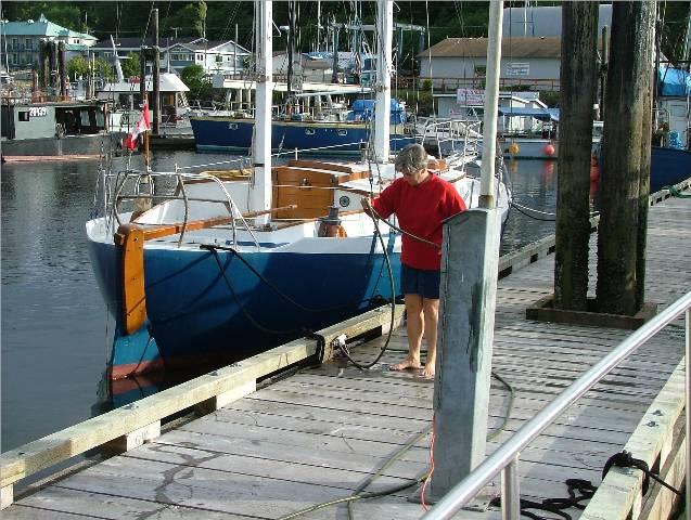
Carol-Ann on the Hose
Red Skies at Night Sailors’
Delight in Port Hardy Harbour |
I had checked the tide tables yesterday to see when low tide was during the day but I neglected to look at them for the low tide that would occur through the night. When I got up at 0700 we were in 4.5 feet of water! We can go to about 3.5 before we’re sitting on the bottom. It was a very low, low tide as the full moon is approaching. Luckily, the tide was at its lowest and now would begin to rise. By the time Rick walked Kona and we got ready to shove off we had another foot of water under us and it was safe to pull the anchor up and start the engine. The weather forecasted up to 15 knots of wind in Queen Charlotte Strait rising in the afternoon. We decided to head to Port Hardy and we would likely get there before the winds picked up. Rick phoned the fuel dock there and was further motivated to go to Port Hardy when they told him the price for diesel was $.89 a litre including taxes! We needed 900 litres so that would be a tidy sum even at such a low price. He figured out we have to this point been burning 2.5 litres of fuel per hour. Very economical travel! The going was easy and we enjoyed a smooth sea until we reached the north end of Malcolm Island and the protection from the northwest that it provided. Once clear of it the sea picked up to a two foot chop. When we reached the fuel dock in Port Hardy the wind started to pick up as predicted and we were glad we were in for the rest of the day. Most of the fishing boats are not at dock and we had no trouble finding a spot at the public floats. We tied up and proceeded to walk to town to buy some fruit and veggies. Kona and Rick waited in “Stinky Creek” park while I went into the Overwaitea. When we got back to the dock we washed the boat down, filled the water tanks and off loaded the trash in preparation for our trip still further north tomorrow. This would be our last stop for food and water and likely cell phone reception for awhile. The weather outlook for Queen Charlotte Sound and the area we will next need to transit is for light winds. We will likely travel part of the way tomorrow to get in position for the trip around Cape Caution Tuesday morning. The area at Cape Caution across from Vancouver Island on the mainland side is no longer protected by Vancouver Island and can be a gnarly piece of water if the weather isn’t right for the crossing. The swells from the open ocean come right through there and it is relatively shallow all around that point of land so the waves tend to be steeper as the water moves into the shore. Once you get over there successfully you can get up into the inlets there and behind several islands that form the Inside Passage. We plan to travel as far north as the top of Calvert Island which is part of the Hakai Pass Recreational Area. You could easily spend two months poking in and around the inlets, bays and coves up in this area. We barbequed dinner, worked on the log and retired by 2100 for another early start tomorrow, hopefully before any waves have a chance to start up as the weather tomorrow is predicted to be moderate to strong northwesterlies. |